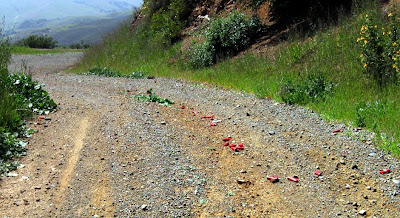
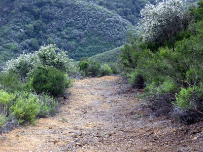
( Cerro Alto --in Los Padres National forest near Atascadero Ca. )
4-29-10
Today I met some interesting hikers at the top of Cerro Alto .
Dennis Vaca of Atascadero says they were training for an endurance race
of 50 miles.
As a daily hiker of this mountain , I found this to be a rare sight as riders usually only climb half way up this mountain .
I have also included some local color --- one a beautiful flower arrangement and the other some shot gun shell litter , both found this day on this beautiful mountain .
I will return tomorrow with a bag to clean up the shells as there were to many on the road to store in my pockets .
Friday, April 30, 2010
Monday, April 19, 2010
Manzana river trail
Manzana Canyon is located in the San Rafael Wilderness ) east of Los Olivos Ca . In Santa Barbara County )
Thanks to Kris Madaus here is the Manzana School House----------------
Thanks Kris .
Saturday April 10,2010 I hiked with four friends down the Manzana river trail to the Manzana School House camping area . I did not get a photo of the school house but Khris Madaus promised to send one to me and when he does I will post same . The weather was cool and sunny . The trail 9 miles one way and wet . We crossed the river 32 times while carrying a back pack . This trail is rich with history as far back as the 1800s when homesteaders settled there .
Big Falls 4-2010
( Big Fall trail is located in the Los Padres National forest ) east of Santa Margarita Ca ., in San Luis Obispo Co.
For those of you who are not familiar with same , this trail can be accessed from High Mountain Road above Pozo Ca.
I love hiking a longer version starting at the trail head of Rinconada trail off Pozo road to High Mountain road and then west on High Mountain road for approx 1.5 miles to Big falls trail head and then 3 miles down to the falls . total loop is 12 miles .
Saturday April 17 , I finally succeeded in
finding Big Falls with a full water fall .
The wild flowers were in full bloom and
much trail work completed . The weather
and very warm , I met many
hikers . Some were even fishing . All was good !
Wednesday, April 7, 2010
Rinconada trail 4-10
Rinconada trail is located in the Los Padres National forest in San Luis Obispo Co. Cal.
e/of Santa Margarita Ca.
April 3-10
I hiked the Rinconada Trail out of Pozo up to the High Mountain road and then big falls. For photos of Big Falls see archived posting Big Falls . The weather was great and the wild flowers have started to blossom , see following posting . I have included here a photo of rangers on horse back as this was a first for me to see mounted rangers in this area . They said that the Little Falls trail has just been improved and if you have seen this trail before you will surely remember how eroded , narrow and steep it is . Also the sign and gate missing for years. here are photos of the new sign and trail head . Also note the improved trail shot in the distance . The trail has been widened to 7 ft. Sorry , the trail is still just as steep as before , strenious !!
Subscribe to:
Posts (Atom)